March Madness: Mokuleia Forest Reserve with a Side of Brisket

This spring has been rainy and cloudy and I've found myself in more of a Netflix and Chill mode than a get out and explore and hike mode. But, I did still get out some this month, so here is a recap of part of the Mokuleia Forest Reserve trail.

The Mokuleia Forest Reserve is located on the Northshore, Waialua side, of O'ahu. It is just a short ride through the pineapple fields just past Wahiawa and down a two lane country road past Waialua High School. I have driven past the big gates at the start of the trail numerous times en route to Ka'ena Point (north shore side), the beaches in Mokuleia, and another popular hike known as switchbacks or Kealia Trail. A couple of weeks ago, I finally stopped at those gates and embarked on an uphill, paved hike in humid and cloudy conditions with my hiking girls Sarah and Mary.

The Mokuleia Forest Reserve is also known as Peacock Flats. There is a campgrounds and access to the area both from the north shore and also with a permit on the west side of the island in Waianae. Since we were coming from Mililani and did not have a permit, we opted with the north shore side. This trail system is about 11 miles. We hiked in three miles and hiked back out making our total for the day six. One of these days when we don't have school pick up obligations, our hikes will increase in length.

For the purposes of exploring new territory and getting outside, this paved trail accomplished our task. This is a terrific trail for those hiking with young children or for bike riding, stroller pushing, or wagon riding. In fact, at the beginning of the trail we saw a large group of pre-schoolers and their moms riding tricycles, scooters, and skateboards (the kids, not the moms). They were safe from traffic and surrounded by palm and fruit trees. Not a bad morning out for the toddler set. The trail starts out relatively flat and with views of north shore farm land with horses, cattle, and peacocks cruising around in the distance.

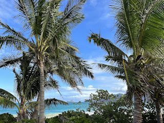
And then the uphill climb begins and you are suddenly hating life. On a non-cloudy day you would at least have a magnificent view of the ocean and the Haleiwa side of the north shore to ease your mental anguish, burning calf muscles, and out of breath gasping...not us. The clouds provided a perfect cover over the non-shaded steep path, but it increased the humidity tenfold...and worked against us in glimpsing any real view. I fear there might be no perfect condition in which to approach this hike.


When we reached a flat and clear portion of the trail just before mile marker three, we took a little breather, drank our water, took our mandatory jump photos and then booked it down the hill trying to better our time, sweat a little extra, and burn a few more calories before hitting up a new favorite north shore eatery, Dat Cajun Guy in Haleiwa.

I would do this trail again, when I wasn't as pressed for time so I could take the hill at a slower pace. I would also like to go further and reach the point where North meets West in the mountains. For now, I'm glad I got to see where this road off the country road led. I'm happy to know that I have another hike in my back pocket for those rainy days when I just can't be bothered to hike through countless mud pits. Although paved paths aren't the ideal way to hike, sometimes you gotta be happy with what you got.

Until the next rainy day...which I hope is a long time from now...here's to paved paths close to home!


And for those curious about our post hike meal...

The Brisket. Always the brisket.

The messy, two handi-wipes, sauce dripping down your face, mouthwatering brisket.

Couldn't even take a decent photo of it because we couldn't wait to eat it...brisket.

In case it was unclear...order the brisket. But be sure you hike first.


Comments
Post a Comment